Show the map
Oursiere - Grande Lauziere - Grand Doménon - Lance de Domène- Colon
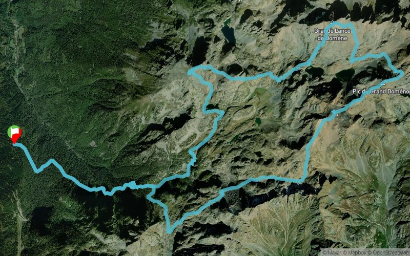


27.9 km
2680 m
2680 m
 Chamrousse (38)
 Points of Interest table
| Accum. | Intermediary | |||||||
|---|---|---|---|---|---|---|---|---|
| POI | Description | Alt. | Dist. | D+ | D- | Dist. | D+ | D- |
Trace n°124297
Ascent threshold : 3 m Distance threshold : 30 m Smoothing : Yes Origin of altitudes : MNT Aster GDEM
Ascent threshold : 3 m Distance threshold : 30 m Smoothing : Yes Origin of altitudes : MNT Aster GDEM
Loop
Dominant terrain : Footpath
Max alti. : 2779 m
Avg alti. : 1954 m
Min alti. : 1124 m
Longest ascent : 1540 m
Longest descent : 1390 m
Route completed by the author : Yes
Dominant terrain : Footpath
Max alti. : 2779 m
Avg alti. : 1954 m
Min alti. : 1124 m
Longest ascent : 1540 m
Longest descent : 1390 m
Route completed by the author : Yes
Elevation profile
More tools
Create a new roadbook page
Map and track on your website
Warning ! When you insert a Trace de Trail map on your website, you agree not to hide any element of the module (links to Trail Trail or Trail Connect banner)
Add a realisation
Validate
Add a realisation to share your chrono and describe the conditions that you encountered during you trail running !
Add a comment
Validate
Bers3ker3
03/08/20, 13:26:34
Bonjour, J’aimerais faire ce trail mais je voudrais savoir combien de temps en moyenne cela prendrais telle ? Merci
03/08/20, 13:26:34
Bonjour, J’aimerais faire ce trail mais je voudrais savoir combien de temps en moyenne cela prendrais telle ? Merci
Show the infos
Add a track